Mokst Butte
by Andy Zeigert
3 min read
It felt like time to do some old-fashioned geoblogging.
I went for a hike at Mokst Butte near Newberry Volcano on May 8 to gather some info for a mapping project I'm working on.
Mokst Butte is a cinder cone on the north flank of Newberry, with an elevation of 1,880 meters (6,168 ft) and a relief (height above the surrounding area) of about 176 meters (577 ft). The butte (and subsequently the nearby lava flow) was named by the Forest Service with the Chinook jargon word for two. A series of buttes in the area were named in this way, likely in the early 20th century. 1
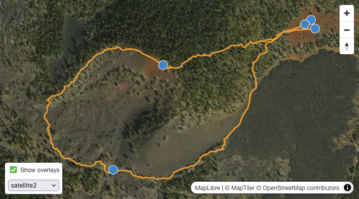
There is a large staging area to the east of the butte that can be accessed from Forest Road 9710, which follows the northern edge of the official volcanic monument boundary. The staging area is red cinder and largely free of trees. It appears to be used for some bonfires, but there are at least three interesting petroforms: two medicine wheels and one labyrinth. They are marked in the staging area to the east in the map above.
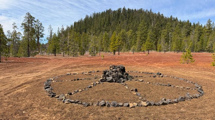 One of several petroforms near the base of Mokst Butte.
There appears to be no established trail ascending the butte itself. It's either a scramble up razor-sharp boulders and scree on the south and west flanks or ankle-deep duff and dead fall on the east and north. Either way, straight up seems to be the best way. No signage in staging area to aid, no published trail map that the author could find. There is a Forest Service survey marker at the summit. Mokst Butte is a designated Research Natural Area.
My GPS track is shown in the map above. Since there was no signage, I decided to try circling the base of the butte clockwise to look for a trail. I found none, although there were signs of other hikers here and there.
It's rough going on foot, but the area offers some fantastic geological sites. I encountered one large folded lava structure that I called "the Whale" because it bore a vague resemblence to a beached whale. It's located at the southwesternmost point on the map above.
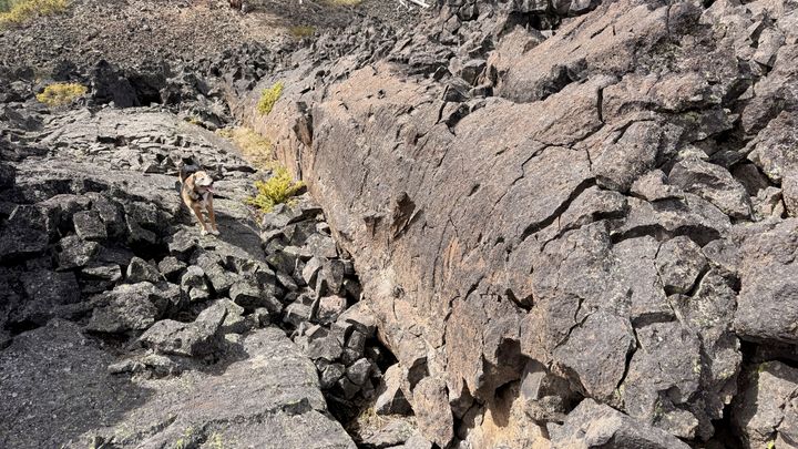 The Whale and the dog. You might have to see it in person to see what I saw.
The summit itself offers excellent views in almost every direction, from the Cascades to the east and a fine view of Newberry Crater to the south. The geology is mostly basaltic andesite with some vent and pyroclastic rocks as well.
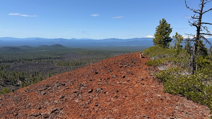 View from the summit, looking east-ish.
If you want to bring a dog, I'd recommend booties. The route I took involved scrambling over a lot of sharp rock.
Travel time from Bend: 40 minutes
Difficulty: 4/5
Best dates: Late April to early May, after the snow is gone but before it gets too hot
Note:
I'm also tentatively using this post as a test page for a Lume plugin for rendering maps, apologies if this page breaks while I muck with the plugin.